


 *To display shelter locations: click on this icon in the top left corner of the map (menu options will expand). Scroll down and check the "Appalachian Trail Shelters" box.
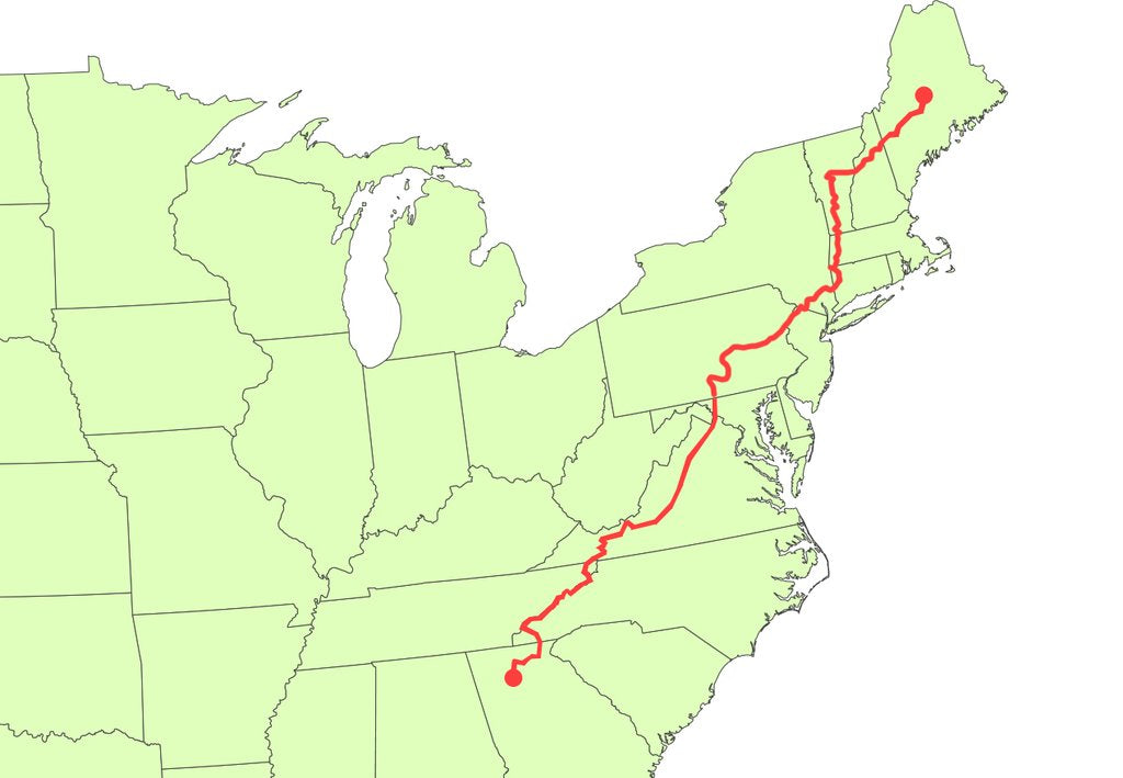
GEORGIA

Length: 78.5 miles (0 to 78.5)
Highest Point: 4,458 ft (Blood Mountain)
Overview and Why it is Awesome:
Springer Mountain has become an iconic landmark for the Appalachian Trail. This is where it all begins (or ends). Blood Mountain is the first big mountain for Northbounders. It has stunning panoramic views of the surrounding mountains. An historic stone shelter, built in 1934 by the CCC (Civilian Conservation Corps) is perched on the summit.
Mountain Crossings Outfitters at Neels Gap is the first real hostel and outfitter you will reach. It is also the only man made structure the AT goes through. A tree full of hanging hiker boots stands as a marker for all of those who have come before. Most thru-hikers go through what is called a ‘shakedown’ here. The employees at Mountain Crossings are seasoned hikers and can provide a lot of gear advice, help lighten your load and ship home any unwanted stuff.
Despite being the warmest state the AT goes through, Georgia is often the coldest section for most thru-hikers. It can still snow in March in North Georgia when the big bubble of Nourthbounders sets off. This harsh weather at the start can be a tough test for any wary hikers. Southbounders finishing in Georgia in November have been known to encounter heavy snow storms as well (I did!).
As far as terrain, Georgia is a fairly easy to moderate section of the AT. The Trail is well marked and well maintained. There are not any bogs, swamps or heavily rocky areas either. Keep in mind there is plenty of elevation gain though.
TENNESSEE/ NORTH CAROLINA

Length: 386.7 miles (78.5 to 465.1)
Highest Point: 6,643 ft (Clingman’s Dome)
Overview and Why it’s Awesome:
Tennessee and North Carolina are listed as ‘one state’ here because the Trail snakes in and out along their border making it hard to differentiate the two.
When I think of North Carolina and Tennessee, I think of wild flowers, flowing streams, spruce-fir forest and grassy balds. This is generally a favorite state(s) for thru-hikers… myself included.
There are two record-high elevation landmarks in this section; Roan High Knob Shelter and Clingman’s Dome. At 6,285 ft, Roan High Knob Shelter is the highest shelter on the AT. At 6,643 ft, Clingman’s Dome is the highest point on the AT. ‘The Smokys’. The Trail goes through 70 miles of the Great Smoky Mountains.
This section contains the largest old growth forest and the densest population of black bears in the East. ‘Old growth’ means forest that has been relatively undisturbed by man (logging, etc). These trees are massive and feel prehistoric. I had no idea how little old growth actually remained in the USA until I hiked through this section. The spruce-fir forest is simply majestic.
There are several famous grassy balds like Hump Mountain and Max Patch here as well. Roan Highlands is a small section that contains the longest stretch of grassy bald on the entire Trail. The Trail goes along an elevated, open, grassy ridge line with amazing views.
Hot Springs, NC is one of the most popular trail towns. It is an historic and charming town with fewer than 1,000 citizens. You can walk down the main street to French Broad River or to one of the only natural hot springs in the entire Southeast.
VIRGINIA

Length: 540.6 miles (465.1 to 1,005.7)
Highest Point: 5,729 ft (Mt. Rogers down a short side trail)
Overview and Why it’s Awesome:
This state is massive. It makes up 25% of the entire trail length. Many people get what are known as the “Virginia Blues” because it feels so endless.
Damascus is one of the most well known trail towns for it’s famous festival, Trail Days. Most Northbounders bottle neck into Damascus for the festival in mid May. Wood’s Hole hostel was one of my favorite hostels. Set half a mile off trail, this log cabin and 100 acre farm was built in the 1880’s. The owners make some great homemade meals.
A group of ponies was introduced to Grayson Highlands State Park several hundred years ago. Since then, they have grown to a herd over 100 strong and freely graze the grasslands. In addition to ponies, the Grayson Highlands section offers long, flat trails with big views at 5,000 ft above sea level.
McAfee Knob is the 'most photographed spot' on the Appalachian Trail. This emblematic rock jets out like Pride Rock from the Lion King and is the cover of the movie, “A Walk in the Woods”. The Trail continues to follow the beautiful limestone ledge into Tinker Cliffs and provides even more views.
The Shenandoahs, or ‘Shenny’s’, is a 75 mile long subrange of the Appalachian Mountains located in central Virginia. The high concentration of black bears and beautiful overlooks make it a popular and more touristy section (Shenandoah National Park) of the Trail.
Virginia is known for quality trail with gradual climbs. It is not flat by any means. There are plenty of big climbs as well as the ‘roller coaster’ section. But, because it has less elevation than some other states, it is often thought of as flat in comparison.
WEST VIRGINIA

Length: 17.7 miles (1,005.7 to 1,023.4)
Highest Point: 1,650 ft
Overview and Why it’s Awesome:
This section is tiny and can be covered in a day. The main attraction in West Virginia is the historic town, Harper’s Ferry. While not exactly halfway, it is considered the ‘halfway hub’. Meaning this is the largest town near the halfway point. Most hikers use this point to flip-flop north or south from.
The Appalachian Trail Conservancy is headquartered here and will take your photograph to be placed in the hiker archives. These books document decades worth of thousands of hikers. This is as official as it gets for your thru-hiker award and recognition status.
The town is situated at the confluence of the historical Shenandoah River and Potomac River. I recommend reading Midnight Rising before you reach Harper’s Ferry. It tells the tale of the famous raid on Harper’s Ferry by the abolitionist John Brown.
MARYLAND

Length: 40.6 miles (1,023.4 to 1,064)
Highest Point: 1,795 ft
Overview and Why it’s Awesome:
I wish I had something awesome to say about Maryland. There was nothing bad about it, but nothing too noteworthy either. You also cross a ‘Mason-Dixon Line’ marker from Maryland into Pennsylvania and a nice overlook at Washington Monument.
PENNSYLVANIA

Length: 229.3 miles (1,064 to 1,293.3)
Highest Point: 2,040 ft
Overview and Why it’s Awesome:
Pennsylvania is one of the flattest states. But, rocks, rocks, rocks. Maybe some more rocks after that. The rocks are often about the size of basketballs and notorious for turning ankles. The constant angling of ankles can be extremely frustrating on long days when you just want to WALK and not tip toe or calculate every hop.
Pennsylvania destroys shoes and will test your rattlesnake spotting ability. Out of only a handful of rattlesnake sightings, most of mine were in Pennsylvania. The Doyle Hotel is a must stop. This place has character. Originally built in the late 1700’s and rebuilt after a fire in the early 1900’s, it hosted many famous residents like Charles Dickens. It has inexpensive rooms and a great second floor balcony to chomp down on a burger and enjoy cold beer.
A few more random notes. There seemed to be a lot of ‘Chicken of the Woods’ growing in Pennsylvania which is an edible mushroom that grows in huge orange patches on wet logs and trees. I saw several groups of Amish hiking and a horse and carriage at a road crossing as well. The Pinnacle is a big climb with a great view.
NEW JERSEY

Length: 72.1 miles (1,293.3 to 1,365.4)
Highest Point: 1,653 ft (Sunrise Mountain)
Overview and Why it’s Awesome:
A lot more wildlife than expected. Expect several bear sightings and a beautiful wildlife sanctuary. The Trail wraps around the perimeter of the grassy sanctuary. I saw several bald eagles flying, nesting and feeding. Sunfish Pond is beautiful - a pristine and glass-like body of water engulfed by rich forest. There is a massive 1.5 mile wooden boardwalk in New Jersey that is great for an easy stroll.
NEW YORK

Length: 92.6 miles to (1,365.4 to 1,458)
*Note the trail overlaps in and out of CT and NY here.
Highest Point: 1,433 ft (Prospect Rock)
Overview and Why it’s Awesome:
You are able to see the New York City skyline off in the distance for a small section. There is even a railroad station on the Trail that takes you directly into Grand Central Station. A two hour ride and you can go see The Big Apple. Just be aware of your smell. Most subway passengers were not pleased with my hygiene. Lifting up my arms to hold on to the handles was like activating a six foot impenetrable forcefield.
You will cross over the famous Hudson River and pass West Point Academy where Dwight D. Eisenhower, Robert E.Lee, George S. Patton and a boatload of other notable military leaders graduated from. Just after the bridge is a ‘trail zoo’ that hosts rescued animals. Black bears, coyotes, owls, snakes and a wide variety of other animals from the area are there. Just next door is a trail museum.
A few more notes… New York has the biggest tree on the entire Trail. No hitchhiking in New York. Probably the most most crowded section for hiking. Bear Mountain was particularly congested. Bear Mountain, at 124 ft, is also the lowest point on the Trail.
CONNECTICUT

Length: 47.8 miles (1,458 to 1505.8)
Highest Point: 2,316 (Bear Mountain)
Overview and Why it’s Awesome:
Similar to West Virginia and Maryland, this section is small. Still pretty, but not much noteworthy. No wildfires are permitted. Bulls Bridge was a highlight. There is a rope swing and a small convenience store nearby. My hiking crew and I sprawled out eating junk food and swinging into the river for hours.
MASSACHUSETTS

Length: 90.5 miles (1,505.8 to 1,596.3)
Highest Point: 3,491 (Mt. Greylock)
Overview and Why it’s Awesome:
Mt. Greylock is a landmark. You can see five states from it’s summit and many famous people have reached it. The author of Moby Dick, Herman Melville, is said to have gotten inspiration for the big whale from this humped mountain. Mt. Everett is another beauty full of old growth pitch pine and scrub oak.
Upper Goose Pond was a favorite shelter. It is actually more of a private cabin than a shelter. It is .5 miles off trail and nestled on the edge of a beautiful pond. You can take the canoes out, go for a swim and get some sun. We canoed to the other end of the pond and ordered some pizza to a parking lot and canoed back at sunset. The next morning, some caretakers made us all-you-can-eat pancakes for free. Hallelujah!
Some parts of Massachusetts are congested. Not by foot traffic, but by houses. You will walk through several backyards and a few neighborhoods.
VERMONT

Length: 150.1 miles (1,596.3 to 1,746.4)
Highest Point: 3,908 ft (Cooper Lodge Shelter/ Killington Peak)
Overview and Why it’s Awesome:
This was my favorite section of the Trail. I remember having a lot of fun in Vermont and, for the first time, really enjoying the Appalachian Trail as a lifestyle (remember, I was SOBO). Vermont does not have the most dramatic mountains or breathtaking overlooks. It does not have any iconic AT landmarks or particularly unique wildlife either. To me, though, Vermont just felt peaceful.
The Trail is much more moderate which was a huge relief from the relentlessly harsh climbs in Maine and New Hampshire. Also, I had developed what are referred to as my ‘trail legs’. This is when your legs are in shape for hiking. The aches and pains are never ending throughout the hike for most people. However, they are much worse at the beginning of the Trail and become more subtle once you get your sturdy trail legs.
In late July, everything is a lush green. Many parts have wild flowers and thick grasses hugging the dirt footpath. Wild blueberry patches are a daily encounter.
The SOBO bubble (if there ever was one) had thinned out and I was hiking with some great folks.
One of my favorite nights was on top of Mt. Bromley. It is used for skiing in winter and has wide mowed down sections leftover from the routes in summer. There is a gondola perched on top and a small hut that is open for thru-hikers to sleep in. Three of us watched the sunset from the gondola. The stars were particularly bright that night and we stayed up for hours watching them by the fire.
Stratton Mountain is where James P. Taylor conceived the Long Trail and also where Benton Mackaye conceived The Appalachian Trail. There is a small fire tower on top for a better view.
NEW HAMPSHIRE

Length: 160.9 miles (1,746.4 to 1,907.3)
Highest Point: 6,288 ft (Mt. Washington)
Overview and Why it’s Awesome:
New Hampshire contains some of the most dramatic landscape - big mountains and epic overlooks. It has the largest amount of above-treeline-trail than any other state. This is considered to be the toughest state. The trail is poorly graded and often without switchbacks making the climbs much more taxing on your body.
The Presidential Range is a subrange of The White Mountains and contains the highest mountains in the Northeast. As mentioned, Mt. Washington once held the world record for wind speeds and continues to be a potentially dangerous summit (don’t forget to moon the cog railway full of tourists on their way to the summit - an old thru-hiker tradition). There are a couple of ponds scattered along the Trail here as well. On a clear day, they will mirror the sky. Franconia Ridge is another stunning section just before The Presidential Range.
Hanover, NH is the home of the Dartmouth College and the Trail goes right through town. There is a strong trail angel support system here. We enjoyed free food at some restaurants and free places to stay with great hosts.
MAINE

Length: 281.8 miles (1907.3 to 2189.1)
Highest Point: 5,268 ft (Mt. Katahdin)
Overview and Why it’s Awesome:
“No pain, no Maine”… so the phrase goes. Maine is a big state and has some rough trail. If New Hampshire is rugged peaks, then Maine is rugged trail. As in wet roots, rocks, moss and mud everywhere. Every step and foot placement takes a little more consideration in Maine. The Southern states are known for well maintained trail. Not Maine. Similar to New Hampshire, Maine has some unforgiving and steep climbs with minimal (or no) switchbacks.
The Mahoosuc Notch is often called ‘the toughest mile’ on the AT. This mile stretch is full of massive shelter-size boulders. To get through the boulder field, you will need to set aside your trekking poles and rock scramble. I loved it. It felt good to jump around and duck underneath the rocks.
The 100 Mile Wilderness is a remote wilderness nearly submerged in wetlands. Crossing only a few gravel roads, this is as pristine as it gets on the Appalachian Trail. This is also where you are most likely to spot a moose. There are bogs, waterfalls and rocky river crossings. The 100 Mile Wilderness is the last section fro NOBOs just before Mt. Katahdin.
…and the big beauty Mt. Katahdin. The iconic end of the trail for Northbounders and the beginning for Southbounders. Henry David Thoreau famously climbed it in the 1800's. The highest mountain in Maine, Mt. Katahdin is a dramatic climb that requires some more boulder scrambling. The summit has one of the best views on the entire Appalachian Trail… and celebration awaits.
For weather and safety concerns, Mt. Katahdin is not available to climb past October 15th.
Maps are not necessary to navigate the Appalachian Trail. The Trail is very well marked by white blazes (2 x 6" strip of paint) about every 50 yards. However, here is a complete list of National Geographic maps available. About $12 to $15 each.

 650-Calorie Fuel