


The Ozark Highlands Trail showcases the unique beauty of the Ozarks in Arkansas. The landscape is filled with glistening waterfalls, limestone arches, wildlife, and miles of healthy forests.
Table of Content
Trail Overview

Length: 165 miles (265km)
Time to hike: 10-14 days
Start and End Points:
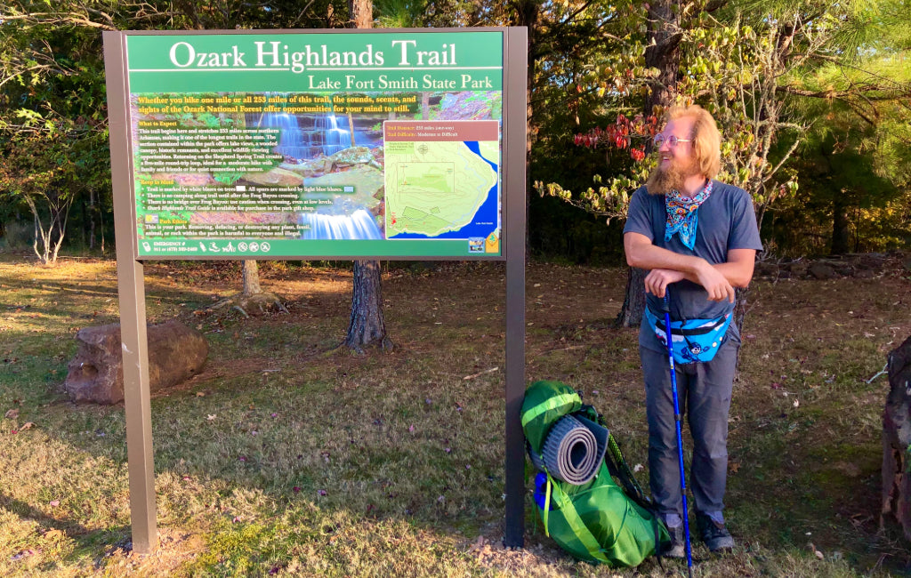
- The Eastern Terminus is at Lake Fort Smith Visitor Center
- The Western Terminus is at Woolum Campground
Highest Elevation: 2350ft (716m). It is located at Mile 41.2 (66.3km) going Eastbound. There is no notable landmark here.
Lowest Elevation: Buffalo River, 648ft (197m).
The U.S. Forest Service started construction of the OHT in 1977. Due to funding, the project was later taken by volunteers, and in 1989 it became a National Recreation Trail. The trail showcases the Ozark Plateau Province which is an eroded plateau that resembles small mountains. The landscape is heavily forested, full of waterways, and geologically impressive.
The trail can be very rocky, muddy, or even dangerous at times with its water crossings. Though the landscape is relatively low in elevation, the trail is by no means flat. It has many short but steep climbs and descents.
The OHT goes through the Ozark National Forest as well as the Buffalo National River. Though a popular area for visitors, the trail itself is less traveled and great for solitude.

Planning Your Thru-Hike
HOW LONG:
There are currently 270 miles (434km) of trail built. These miles, though, are not entirely connected. Bushwhacking, as well as long road walks, are required to hike the trail in its entirety. When the OHT is finished it will be around 320 miles (515km) up to the Missouri state border. While the western terminus is easily defined, the eastern terminus is up for debate among hikers.
 ©
©However, there are two most common versions of a thru-hike currently. The most common is a 165-mile (265km) thru-hike known now as the Boston Mountains, or the “old” route. This is the route used for any FKT’s. It will take between 10-14 days to thru-hike. The less popular, longest continuous piece is 207 miles (333km), which includes the Boston Mountains and the Buffalo River. Its eastern terminus is at Hwy 14 & Dillard’s Ferry. This does include about 15 miles (24km) of bushwhacking. Thru-hiking this way will take between 12-16 days.
For this article, we’ll be focusing on the 165-mile (265km) version of a thru-hike. The reason being is that it has the most reliable information and is the most popular. Action is currently being taken by the Ozark Highlands Trail Association to make well-defined extensions, and within a few years, the trail will most likely be more connected on its eastern side.
 ©
©WHEN TO GO:
The Ozarks are a warm and temperate zone. It receives around 50 inches (127 cm) of rain per year and rains about 100 days of the year. It receives around 3 inches (7.6 cm) of snow yearly. Ideally, you’ll want to time your hike to have plenty of water so waterfalls are plentiful, but not so flooded that the water crossings become life-risking. It is a good idea to check river and creek levels around the trail before going.
Mid-October through early June is the best time to hike this trail. A summer hike is unpleasant due to the heat, humidity, low water, overgrowth of plants (including poison ivy, poison oak, and many types of thorny vines), ticks, tick-borne illness, chiggers, and mosquitos.
 ©
©Here are the benefits of hiking during the other seasons.
-Autumn (Mid-October- early December): The fall foliage makes the trail more colorful. It is dryer (though still wet) and generally comfortable temperatures. There is also an abundance of stick bugs (walking sticks).
-Winter (Mid-December- early March): The landscape rarely gets below freezing. The trees, now barren of leaves, make views more abundant. This is a great time for solitude.
-Spring (Mid-March- early June): The trail is rainier this time of year, but that makes the many waterfalls along the trail more abundant and bountiful. This is the most popular season for hiking this trail.
 ©
©GETTING THERE:
Trailheads aren’t very difficult to access, especially the western terminus at Lake Fort Smith Visitor Center. Woolum Campground (The eastern terminus) is on a gravel road but still fairly easy to access. There are several shuttle services available on the OHT website which covers the whole trail. The best place to fly in would be Fort Smith Regional Airport.
 ©
©EASTBOUND OR WESTBOUND:
There isn’t any preferred way to hike this trail. It is easier, however, to access the western terminus. The trail is more difficult with elevation gain/loss on its eastern side, but it isn’t by much. More hikers do go eastbound due to the western terminus being easier to get to. Going westbound would mean that you have to cross the Buffalo River almost immediately, which can be very high at times.

MAPS AND APPS:
Guthook and Gaia are both good apps for navigation. Guthook still lacks a lot of user input, and thus makes it easy to miss a lot of the sights to see. There are maps available for the trail on the OHT website, which is well detailed. Tim Ernst wrote the OHT Guide, which helps enhance a lot of hikers' experiences, and is highly recommended.
 ©
©GEAR AND CLOTHING:
It is important that you have some rain gear, like a poncho. Even dryer seasons can have days of rain. A bear canister isn’t necessary, but hanging your food is a good rule of thumb, due to the smaller animals.
 ©
©WHERE TO SLEEP:
There is a variety of nicely constructed campsites throughout the trail. These campsites are mostly smaller, often having a fire pit. They can be found every few miles. If needed, stealth camping is permitted. There are no constructed shelters along the trail. However, there are plenty of old abandoned rock houses and protruding rock walls for cover in case of bad weather.

HOW TO RESUPPLY:
The trail doesn’t go through any major towns. The best restocking town is Ozone which is at mile 84.7 EaBo (30.7km). There are no grocery stores or gas stations, so sending yourself a package at the post office is the best option. The address for the post office is 101 Highway 21 N, Ozone, AR 72854.
 ©
©The town of Ozone is 2.5 miles (4km) south of the trail via road walk. Although hitching is tough to achieve, it is still possible. The Burger Barn is a popular stop for hikers wanting to eat some burgers and fries, and often they let hikers sleep in the front yard for free. There are charging ports and bathrooms for use.
Ozark Adventure Lodging is a nice place to sleep that provides glamping shelters to sleep in for a cheap price. Both Burger Barn and Ozark Adventure Lodging are found in the town of Ozone.
 ©
©NATURE AND WILDLIFE:
The trail is abundant with wildlife. White-tail deer, black bear, elk, coyotes, bobcats, wild turkey, grouse, squirrels, armadillos, chipmunks, and many species of birds are found all over the OHT. The mornings, as well as the evenings, will be your best bet at animal viewing. The animals here are skittish, so being quiet is a good rule of thumb. While black bears are inhabitants of the trail, there isn’t much need to worry. Most bears here are under 100 lbs (45 kg) and quick to run away into the forests.

Sectional Overview
Section 1: Mile 0-35.3 (0-56.8km)
The westernmost section of the well-known trail is from Lake Fort Smith to Cherry Bend Trailhead. White Rock Mountain is a highlight of this section and provides spacious views of the valley floor. The Rockhouse is a shelter near the trail which can be a great spot to retreat to in case of rain.

Section 2: Mile 35.3-84.7 (56.8-136.3km)
This section of the OHT is from Cherry Bend Trailhead to Ozone Campground. Marinoni Scenic Area has waterfalls, some canyoneering, and even a naturally formed arch. This section ends at the access point for the town of Ozone, which is found about 2.5 miles (4km) south of the trailhead on Highway 21.
Section 3: Mile 84.7-123.8 (136.3-199.2km)
This section of OHT is from the Ozone Campground to Fairview Campground. Hobo Falls is a nice spot to swim and admire the waterfall. A large natural bridge can be seen at mile 109.9 (176.8km) just to the north of the trail.

Section 4: Mile 123.8-165 (199.2-265.2km)
The easternmost section of the trail is from Fairview Trailhead to the Buffalo River, which is near Woolum Campgrounds. This section has some of the best views of rocky outcroppings. At mile 162.8 (262km), be on the lookout for a spur, which leads to some great views of the valley floor. The Buffalo River can be high-crossing, and so waving down someone in their boat may be necessary for safe passage.
The Triple O:
The Ozark Highlands Trail is sandwiched between the Ozark Trail to the north and the Ouachita Trail to the south. Hiking all 3 of these trails is known as the Triple O. All 3 are similar in mileage, difficulty, and are all encompassed within the US Interior Highlands region. The total length would be 617 miles (993km) and would take between 35-50 days.

Resources
- Tim Ernst’s guidebook is the best resource for information. It gives information on side trails that would be hard to find otherwise.
- As far as online groups, The Ozarks Highlands Trail OHT group on Facebook is a good place to gather information.
- The Ozark Highlands Trail is a beloved and well known trail, and for good reason. I would recommend this trail to all skill levels. Water is generally plentiful, logistics are easy, and scenery abundant. It has many side trails and taking time to hike some will enhance your experience.
- Check water levels online before embarking on your thru-hike, so as to have a safe and enjoyable experience.

 650-Calorie Fuel