


To Print PDF: Step 1) Expand to full screen view (click box in top right hand corner of map). Step 2) Zoom in to your desired map section view. Step 3) Click on the three white vertical dots and then "Print Map" from that drop down menu.
John Muir Trail Overview
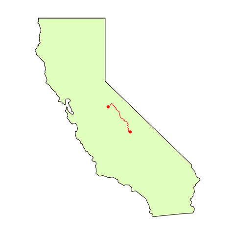
Length: 211 miles
Highest Elevation: Mount Whitney, 14,505 ft (4,421 m)
Lowest Elevation: Happy Isles trailhead, Yosemite Valley, 4,035 ft (1,230 m)
Start and End Points:
- the Southern terminus is the summit of Mount Whitney, which is accessible via a 10-mile hike from the Whitney Portal trailhead
- the Northern terminus is the Happy Isles trailhead, in the Yosemite Valley of Yosemite National Park
The John Muir Trail (JMT) is about 211 miles long and usually takes about 3 weeks to complete. It is regarded as one of the most beautiful hiking trails in the US and shares 160 miles with the famous Pacific Crest Trail.
The majority of the trail sits above 8,000 feet, providing pristine views of the surrounding Sierra Nevada mountains. The trail starts in Yosemite National Park and continues through the Ansel Adams Wilderness, Sequoia National Park, King's Canyon National Park, and eventually ends at Mount Whitney at 14,496 ft, the highest peak in the continental United States.
It may be stunning to behold, but the JMT is not an easy trail to hike - hikers will climb a cumulative 47,000 feet in elevation gain. Approximately 1,500 people attempt a thru-hike on the JMT each year.

Planning Your Thru-Hike
WHEN TO GO: Timing, Weather and Seasons
The ideal time to hike the John Muir trail is from June through September. If you head out any earlier than June, the snow pack on the high passes can be slow going and even too treacherous to traverse. If you leave later in the fall, then you may get caught up in severe early season snow storms. Here are a few common times to do it.
Option 1: Start in Early June. You may encounter fewer crowds and ample water, but you'll also have to contend with swarms of mosquitoes, leftover snow on the passes and difficult water crossings that are swollen from the melting snowpack.
Option 2: Start in July and August. These are the most popular months to hike but they are not the best weather-wise. Temperatures can be hot, afternoon thunderstorms are frequent, and the mountain water begins to dwindle. The trail also is more crowded.
Option 3: Start in September. In our opinion, this is the best time to hit the trail. The temperatures are a bit cooler, and the mosquitoes have all but disappeared. Crowds also thin out in the late summer as people head back to school and work.

DIRECTION TO HIKE: Northbound or Southbound?
Most people hike the JMT from north to south (southbound), starting in Yosemite and ending in Mount Whitney.
This northern half of the route starts out easy and has several resupply points allowing you to carry less food early on and get your hiking legs underneath you before hitting the higher elevations of the Sierra Nevadas.
The southern half of the JMT is much more remote and higher in elevation, making it more suitable for hikers who have some trail miles under their belt.

NAVIGATION: Maps and Apps
The JMT is well marked and heavily traveled making it easy to follow. During peak season, you will encounter people going both directions on the trail, so your chances of getting lost are small.
You'll want a map or guidebook, though, to plan your resupply points, pick your camping spots and find a bailout route if your trip takes a downward turn. Here are additional resources we recommend:
-
Guidebook: John Muir Trail by Elizabeth Wenk
-
Apps: Guthook's JMT.

© Ellen
HOW TO RESUPPLY: Food, Water, and Towns
The JMT has several resupply opportunities, especially in the northern section of the trail. On average most resupply points are 50-70 miles apart.
Note the last convenient resupply point on the southbound path is Muir Trail Ranch. Some southbound hikers do a final resupply at Muir Trail Ranch and walk the final 100 miles to Whitney without stopping. There is another resupply location past Muir Trail Ranch if you go to the Onion Valley parking lot, but hiking to that location adds another 15 miles to your trip. You also have to arrange for a ride or hitchhike to the Mt. Williamson Motel or the Independence Post Office to pick up your resupply package.
Another note, don't forget that you still have to hike another 10 miles after summiting Mount Whitney to get to the Whitney Portal trailhead. Make sure you have adequate food and water for the last leg of your trip.
Here is a list of the most popular and convenient resupply points:
| RESUPPLY POINT | COORDINATES | CONTACT |
| Tuolumne Meadows Post Office & Store | 37.874308, -119.35713 | 209-372-8236 |
| Red's Meadow Resort & Pack Station | 37.614806, -119.075120 | 760-934-2345 |
| Mammoth Lakes Post Office | 37.649153, -118.970926 |
760-934-225 |
| Vermilion Valley Resort | 37.376268, -119.011934 |
559-259-4000 |
| Muir Trail Ranch | 37.238092, -118.883181 | howdy@johnmuirtrail.com |
| Mt. Williamson Motel and Base Camp | 36.798300, -118.197472 | 760-878-2121 |
| Independence Post Office | 36.802296, -118.199807 |
760-878-2210
|
SLEEPING: Camping and Accommodation
There are no reserved campsites along the John Muir Trail. Unless otherwise posted, you are asked to camp in an established campsite where others have camped before or on hard ground where you will leave no trace.
Most of your time on the trail will be spent camping on the ground as there are no huts like on the AT. If you have money to spare, you can rent a cabin at the Muir Trail Ranch for $170 per person per night.

WILDLIFE: Sightings and Dangers
Seeing a variety of wildlife is one of the many benefits of hiking the John Muir trail. Unless you are in a big loud group, you will likely encounter wildlife every day.
Mammals: Deer and marmot are ubiquitous, especially at higher elevations. These colorful, outgoing critters will come right up to you when you break for lunch. Another unique mammal you'll encounter near boulder piles or at higher elevations is the pika. You won't often see these small relatives of the rabbit, but you can't miss their distinctive squeaks. Other animals you may see include coyotes, and possibly mountain lions.
Birds: The JMT is home to many birds including the American Dipper which looks like a small robin but is a water-dwelling bird that dives underwater to feast on insects, larvae and other underwater goodies. You also may see (and hear) a Stellar Jay tor spot the Clark's Nutcracker, named for Clark of the famous expedition team Lewis & Clark.
Bears: Bears are common, especially in Yosemite Valley, so you need to take precautions to protect your food and gear. All backpackers are required to carry a bear canister in Yosemite. Bear bagging is not allowed and impossible at higher elevations above treeline. You should place all food, toiletries and scented item in the canister and store it at least 100 feet away from your campsite if possible. You also should store it away from lakes, river or cliffs in case a bear decides to play soccer with your canister while you sleep.
Snakes: You might encounter rattlesnakes so keep your eye peeled.

Permits: How to Apply
Whether you are hiking southbound or northbound, obtaining a permit is the most challenging part of planning for a JMT hike. More than 70% of all applications for a permit are denied, so you need to be patient during the process.
To improve your odds of getting a permit, you should keep your group size as low as possible. You also should be flexible in your departure date and be willing to consider a different departure trailhead.

© Produce
SOUTHBOUND PERMITS
Permits are distributed through a random lottery. If you are leaving from Yosemite, you need to submit your permit via fax six months prior to your departure date (168 to 170 days) and hope your name gets picked.
Check out this handy table from the National Park Service to see all permit reservation windows and find out when you need to apply.
There are five different trailheads you may depart from:
-
Happy Isles to Sunrise/Merced Lakes Pass-Through
-
Happy Isles to Little Yosemite Valley
-
Glacier Point to Little Yosemite Valley
-
Sunrise Lakes (Tenaya Lake South)
-
Lyell Canyon
When filling out your permit application, you will have to rank each trailhead by order of preference and indicate a camp location for your first night.
All trailheads pass through Donahue pass which has an exit quota of 45 hikers per day. The first four trailheads share 20 daily permits while Lyell Canyon has 25 permits, 15 of which are available via reservation and ten which are available on a first-come, first served basis. The permits cost $5 per application and $5 per person, and you are only charged if your permit is approved.
1. Happy Isles Trailhead: Happy Isles trailhead is the official start of the JMT and is the preferred starting point for most thru-hikers.
If you start here, you will pass Half Dome, Nevada Falls, and other iconic Yosemite landmarks. You have two choices for camping - you can hike 4.5 miles and camp in Little Yosemite Valley or walk 6.5 miles to Sunset/Merced Lake where you can camp along Sunset Creek. Sunset Creek is the better choice because you get a longer first day and have more options for camping. It also means you'll have plenty of time to reach the popular camping spot, Cathedral Lake, on day two.
Whatever your choice, you will be gaining some elevation as you climb out of Happy Isles, the lowest point on the JMT.
2. Sunrise/Merced Lake: Sunrise Lake trail begins at the Tenaya Lake trailhead and travels 3.3 miles to the campsites on Sunrise Lakes.
You can park at the Tuolumne Meadows Ranger Station and take the free shuttle to the trailhead. After an hour or two of hiking, you can set up camp on Sunset Creek just past the Clouds Rest junction. From here, you can hike 10-miles round trip up to Clouds Rest which offerers incredible views of Yosemite Valley. You will join the JMT around mile 13 on day two.
One bonus to this option is that you pass by the Tuolumne Meadows Ranger Station again allowing you to pick up/drop off gear in your car or stash food in the bear locker at the station so you can carry less weight on the first few days.
3. Glacier Point: Glacier Point brings you by Nevada, and Vernal Falls, and has incredible views of Yosemite Valley, but it is way off the beaten path.
The trailhead is logistically difficult to get to as it is located an hour from the Yosemite Valley Ranger Station. You avoid some of the crowds and start at a higher elevation, but getting to the trailhead is very difficult if you don't have a pre-arranged ride. Your first night will be spent camping in Little Yosemite Valley.
4. Lyell Canyon (Tuolumne Meadows): The Lyell Canyon option starts at the Tuolumne Meadows Ranger Station. It skips some of iconic Yosemite landmarks including Cathedral Lake, but it avoids the steep climb out of Yosemite Valley.
The first 10 miles of this section is flat allowing you to have an easy first day while you get your hiking legs back. You can camp near Lyell Fork Bridge which has plenty of spaces to set up a tent.

© Richard Wood (CC BY-SA 3.0)
NORTHBOUND PERMITS
Heading northbound doesn't relieve you from having to obtain a permit.
Hikers starting at Mount Whitney will need to get a permit from the Inyo National Forest. Here again, patience and persistence will be key. In 2017, only 35% of all 15,000 people who applied for the permit got one.
Similar to Yosemite, the permits are available via a lottery system occurring between February 1 and March 15. Only 60 overnight permits are issued each day. However, if there are any unfilled spots remaining after the lottery takes place, they are distributed on a first come, first serve basis starting April 1st.
You can make a reservation for one of these open slots up to two days before your trip. Reservations are made online or by calling the Inyo National Forest Wilderness Permit Office (1-760-873-2483).
Hiking the John Muir Trail without a permit is not allowed, so be sure to plan well ahead of your departure date in order to secure one. Permits cost $15 per person, and lottery winners must pay their permit fees before April 30th to retain their spot.
Alternative Entry Points: If you didn't get a permit and are set on hiking the JMT northbound, you could start at an alternative location such as Horseshoe Meadow, Cottonwood Pass or Cottonwood Lakes. These alternative entry points still require a permit, but these are easier to obtain than the ones for Whitney Portal. When choosing where to start, keep in mind that these alternative routes will add additional miles to your trek.
Sectional Overview
YOSEMITE NATIONAL PARK
Happy Isles to Donahue Pass (0 to 37 miles)
The John Muir Trail begins at the Happy Isles trailhead in Yosemite national park. This first section of the trail climbs steeply out of Yosemite Valley passing by several iconic landmarks including Half Dome, Nevada Falls and Cloud Rest.
The trail crosses the Cathedral Range and the popular camping and swimming spot, Cathedral Lake, before dropping down to Tuolumne Meadows and your first resupply point. Here, the JMT merges with the PCT and heads towards Donahue pass, the exit point of Yosemite National Park.
ANSEL ADAMS AND JOHN MUIR WILDERNESS
Donahue Pass to San Joaquin River Bridge (Miles 37 to 112)
After leaving Yosemite, the John Muir Trail enters the scenic lake country of the Inyo National Forest which includes the Ansel Adams and John Muir Wilderness. The trail winds through lake-filled valleys and climbs steep alpine passes that prepare you for the demanding treks up Forester Pass and Mount Whitney at the end of your journey.
You pass by several resupply points in this section, including the Vermillion Valley Resort which can be reached by boat for a fee and the Muir Trail Ranch, the last near-trail resupply point. Muir Trail Ranch also is near the Blayney Hot springs, a popular resting point for weary hikers.

KINGS CANYON
San Joaquin River Bridge to Forester Pass (Mile 112.6 to 187)
Kings Canyon signals the beginning of the big climbs with passes that break the 10K barrier. Enjoy the stunning views of the High Sierras and the raw wilderness of Kings Canyon.
Keep your eyes peeled for the infamous Rock Monster off the trail near Muir Pass.
You'll also hike through Kearsarge Pass and the last chance to resupply by getting off the path and traveling to Onion Valley. This section ends at Forester Pass, marks the border between Kings Canyon and Sequoia National Parks and is the highest pass on the JMT.
SEQUOIA NATIONAL PARK
Forester Pass to Mount Whitney (Mile 187 to 210)
The last few miles on the JMT are all about Mount Whitney. The mountain looms in the distance getting closer and bigger with every step. After the arduous climb up Forester Pass, you'll get some respite as you hike across the relatively flat Bighorn Plateau before starting the long ascent to Mount Whitney.
The JMT ends at the 14,500-foot summit, but you are not done hiking. You still have to log another 10 miles downhill to reach the Whitney Portal and the gateway back to civilization.

© Jeff Moser (CC BY-ND 2.0)
A Note on Altitude Sickness
The John Muir Trail is unique due to its high elevations. As mentioned, most of the trail is above 8,000 feet and some of the passes in the middle section climb to more than 13,000. Because of these elevations, altitude sickness is something hikers need to be aware of.
Common early symptoms include a headache, shortness of breath, nausea, dizziness, and tiredness. If you start experiencing a combination of these symptoms, go back down immediately to a lower elevation for a few days to acclimate before attempting to hit the higher passes.
Some folks choose to acclimate during the hike by spending a few days in Yosemite in the Half Dome area or Tuolumne Meadows before hiking into the High Sierras. Other hikers prefer to "hike high and sleep low" by planning their days so they end each one in a valley and not at the summit where the prolonged exposure to the altitude may affect their health.
Don't brush off the early symptoms of altitude sickness. For some people, these early warning signs lead quickly to more severe altitude effects such as High Altitude Pulmonary Edema (HAPE) which produces shortness of breath and a productive cough sometimes, but not always with bloody sputum.
Hikers may also develop High Altitude Cerebral Edema (HACE) which causes them to become disoriented or stumble when they walk. These conditions can be life-threatening if left untreated. Other less serious altitude effects include retinal hemorrhaging and edema in the face, hands, and feet.

More Resources
Have you hiked the John Muir Trail? What is one tip you wish you had received prior to your departure? Share your advice in the comment box below.

 650-Calorie Fuel