


In this post, we're going to show you how to use a compass in different scenarios so you can easily orient yourself in the wild. In fact, with nothing else but a compass and a map, you'll be able to follow a bearing in the field, find your location on a map and reach any set of GPS coordinates.
But before diving into each scenario, let's look at an important factor that is going to influence how you use a compass - declination.
Understand Declination
North does not necessarily equal north. Yes, you read that right. Declination is the difference between true north and magnetic north. Huh? True north (also called geographic north) is considered to be the top of the globe, where Santa lives. Magnetic north is where your compass points. This difference is "declination"... and usually needs to be calculated and accounted for prior to setting your compass.
What causes declination?
Because of the Earth's magnetic fields, there is a discrepancy between the magnetic north where the compass points and the north that you find on the map, ie the declination. In the United States, the declination can be as high as 20 degrees east on the West Coast and 20 degrees west on the east coast. Knowing this value is essential, if you walk at the wrong heading, you could quickly find yourself miles off course.
Every place on the globe has some degree of declination. The only exception is the agonic line, which connects the north and south magnetic poles and has a zero declination. Compasses within the agonic line will point to both true north and magnetic north simultaneously.

How do you find declination?
You should always check the current declination for your area as it changes due to shifts in the Earth's magnetic north pole. You can find your declination using online tools. You also can check a recent topo map, which should have the declination printed on it somewhere. It will look something like the Declination Diagram shown on the right.
How to find true north with a compass?
Most, but not all, compasses have a declination adjustment. You can set the compass for the declination of the area in which you are using the compass. Once you set the declination, you don't have to worry about it until to change your location. Every manufacturer has a different way of adjusting the declination. Some compasses use a small screw that adjusts the dial, while other compasses require you to push and twist the dial to the correct declination. You'll have to consult the manufacturers manual for your specific model.
Inexpensive compasses do not have a declination adjustment, so you cannot set it and forget it. Math becomes your best friend with these non-adjustable compasses. You must make the adjustment manually by adding or subtracting the amount of the declination.
 In the United States, declination ranges from -20 (eg. Maine) to 20 degrees (eg. Seattle).
How to Use a Compass
A compass may appear very complex at first sight - different colors, numbers, lines going in every direction... However, there are only seven elements we'll be referring to in this tutorial - the orienting arrow, the index line, the "shed", the magnetic needles, the rotating bezel or housing, bearings and orienting lines.
Each one of those will be explained as we go along.

SCENARIO A
You have a bearing you need to follow
In this scenario, we are trying to figure out which direction to walk if given a specific bearing (eg. "follow a bearing of 78°"... or "head southwest").
What's a bearing?
Before we start, it's important to understand what a bearing is and how it is commonly expressed. Simply put, a bearing is the direction in which you must travel, as indicated by a compass. It can be expressed in degrees or using cardinal points:
- Cardinal directions: There are four major cardinal points - North, South, East, West. Each of those can be used in combination with one another to indicate directions that are in-between, such as "North-West" or "East-South-East" (called "intercardinal directions").
- Degrees: While cardinal points are great for providing general directions, degrees are more specific and accurate. Instead of saying "walk southwest", for example, you could tell someone to head at a bearing of 210 degrees. Degrees range from 0 to 360 degrees and are marked clockwise on a compass, usually in increments of 2 or less degrees.
How to follow a bearing, step by step:
1. If needing absolute accuracy, set the declination on your compass (see above).
2. Rotate the bezel (aka housing) so that the index line indicates the bearing you want to follow, in this case 78°. The index line is a small line situated at the top of the rotating bezel, circled in red in the animation below.

3. Holding the compass in front of you, rotate your entire body until the red magnetic needle points to North on the compass (i.e. bearing of 0°) or until "red is in the shed". Oftentimes, the "shed" is represented by two small markers on the background of the compass. We've circled it in white in the animation below.
4. The direction in which your compass is now pointing corresponds to the bearing you need to follow. Start walking, following the arrow at the top of the baseplate. As you walk, make sure that red remains in the shed.
SCENARIO B
You have a map and need to locate where you are
In this scenario, we are going to find our position by reporting the bearings of two or three landmarks on a map - a process known as triangulation.
1. Set the declination on your compass (see above).
2. Start by pointing your compass at a known landmark that can be easily identified on your map, like a summit.

3. Keeping the compass flush with the ground and pointed towards the landmark, turn the rotating bezel of the compass until the North magnetic needle lines up with 0° on the compass (or "red is in the shed"). You've just captured the landmark's bearing, which you can read at the top of the rotating housing, right under the index line.
4. It's time to pull out your map. Find the landmark on the map, and line up one of the long edges of your compass (either left or right) with its position, like shown below.

5. Next, rotate the entire compass (not the bezel) until the North and South markers on the compass align with North and South on the map. You'll notice some lines on the background of your compass. Those can be used to get the alignment just right.

6. Then, simply draw a line along the edge of the compass, starting from the landmark and going backwards, in the opposite direction to the orienting arrow (located at the top of the compass). This line represents you and where you are currently facing.

7. Pick another landmark that you can both see from where you are and identify on the map. For better accuracy, choose a landmark that's at least 20 degrees away from the previous one.
8. Repeat steps 1 to 5
9. The intersection between the two lines you've drawn corresponds to your position on the map (roughly).

10. (optional) For more accuracy, you may want to repeat the process with a third landmark. The three lines will form a small triangle and your position will be somewhere within its borders.
SCENARIO C
You have coordinates you need to get to
In this scenario, we'll first use GPS coordinates to pinpoint our destination on a topographic map. Then, based on our current location, we'll find out what bearing we need to follow to get there.
1. Set the declination on your compass (see above).
2. Using the coordinates, find the location of your destination on the map. If you're not sure how, check out this video tutorial. Note: all maps do not include latitude and longitude - you'll need one that does to complete this scenario.

3. Place the compass on the map and line up its edge so that it connects your location to the point you identified in step 2 (if you don't know where you are, complete scenario B first). The orienting arrow should always point away from where you are and towards your destination. The orienting arrow is located at the top of your baseplate compass; it indicates the way you have to follow.

4. Rotate the bezel of the compass until North and South on the compass line up with North and South on the map. Use the "orienting lines" (perpendicular lines on the background of the bezel) for more precision.

5. Read the degree marking indicated at the top of the compass, right under the index line. That's the bearing you need to follow to get to your destination (if you're not sure how to follow a bearing, review scenario A).
Different Types of Compasses
There are several different types of compasses available to consumers. Though each type has its pros and cons, we will focus exclusively on how to use a baseplate compass in this post.
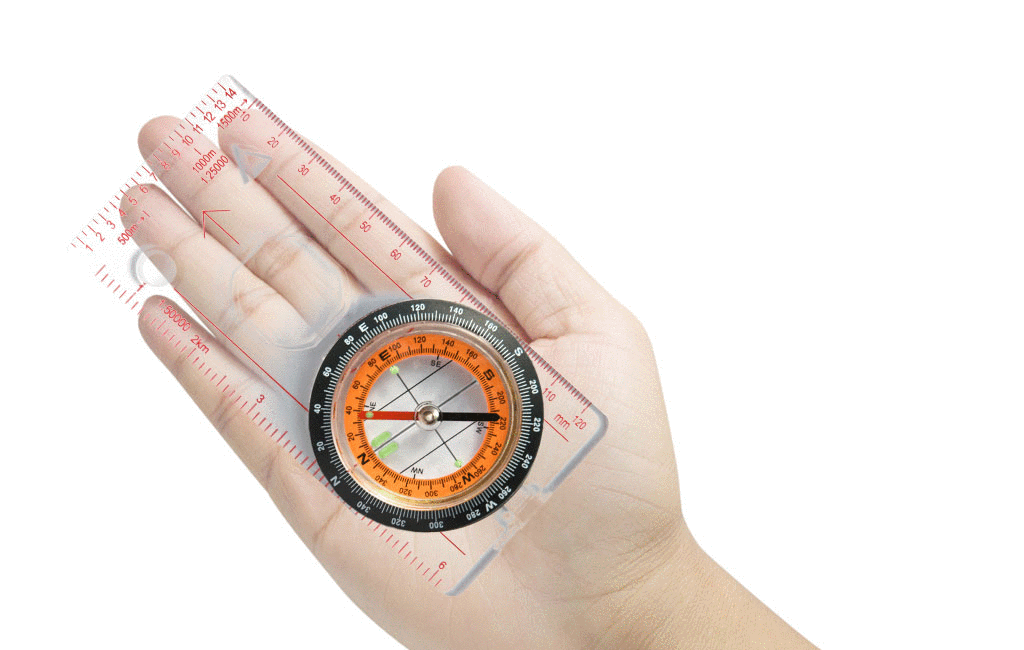
Baseplate Compasses (aka orienteering compass)
Because it is used for orienteering, a baseplate compass is designed to be used with a map. It has a clear rectangular, plastic base that lets you see the features of the map while using the compass. It also has a ruler to measure map distances and a magnifying glass for reading the small print and topographical features. Some compasses even have luminous components for night-time use. Baseplate compasses excel at finding your location and calculating a bearing using a map. Because they don’t have a sighting mechanism, the baseplate compass is more difficult to use when walking according to a bearing.
Lensatic Compasses (aka military)
Also known as a military compass, the lensatic compass is one of the most accurate compasses you can use for walking has three basic parts - a cover, a base and a reading lens. The cover protects the compass and has a sighting wire to help you sight an object in the distance, while the base has the dial and the magnetic compass components. The base also has a thumb loop to help steady the compass while you are holding it. You look through the reading lens when lining up an object with the sight line. A lensatic compass is designed for walking according to a bearing and is less useful when working with a map because it doesn't have a straight edge.
Pocket Compasses
Pocket compasses have been around for ages. They are a small, round compass with a flip-style cover over the dial. As its name implies, this type of compass is small enough to fit in your pocket. Pocket compasses often are cheaply made, so they don't perform as well as the baseplate or lensatic compass. Though they work ok for following a bearing, the pocket compass is not very helpful when reading a map.
Button Compasses
Button compasses are probably the most common compass you will see because they are attached to everything. They are small and extremely cheap. You'll see them attached to keychains, weaved into paracord bracelets, and tacked on to mass-produced survival tools. Buttons compasses are not accurate, break easily and are easy to lose. They should be used only as a toy or a novelty item and not as a land navigation tool.
 Types of compasses (from left to right): baseplate, lensatic, pocket and button
Considerations for Choosing a Compass
There are a handful of features that you need to consider when choosing a compass
Adjustable Declination: Adjustable declination allows you to quickly and easily change the declination on the compass. If you stay in one are, then you don't need this feature. If you travel, being able to change the declination in each location is a huge bonus.
Magnifying Glass: A magnifying glass allows you to view the smaller elements on a topo map. You may not need a magnifying glass to spot a lake, but it is helpful to read elevation, contour lines, bogs, and other small elements on a map.
Glow in the dark: Luminous elements are found on the dial and sometimes the sight line. This feature sounds frivolous until you find yourself needing to consult your map and compass at night.
Clinometer: A clinometer allows you to measure the height of tall objects you typically can’t climb.
Thumb loop: Found on a lensatic compass, a thumb loop is used to steady the compass so you can get the most accurate reading possible.

Recommended Models
Don't own a compass yet? Here are three popular, simple and lightweight options to choose from:
- Weight: 1.1 oz
- Declination adjustment: yes
- Price: $16
- Weight: 1.12 oz
- Declination adjustment: yes
- Price: $14.50
- Weight: 1.44 oz
- Declination adjustment: yes
- Price: $14

 650-Calorie Fuel